|
|
|
Advertisements:
GeographyLocation
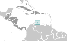
Karibik, Insel in der Karibik, nördlich von Venezuela Geographic coordinates
12 30 N, 69 58 W
Map references
Mittelamerika und die Karibik
Area
Total 180 sq km
Land 180 sq km Water 0 sq km Area - comparative
Etwas größer als Washington, DC Land boundaries
0 km
Coastline
68.5 km
Maritime claims
Territorial sea 12 nm
Climate
Tropische Marine; wenig saisonale Temperatur-variation Terrain
Wohnung mit ein paar Hügel; spärliche Bewuchs Elevation extremes
Lowest point Caribbean Sea 0 m
Highest point Ceru Jamanota 188 m Natural resources
NEGL; weiße Sandstrände
Land use
Arable land 10.53%
Permanent crops 0% Other 89.47% (2005) Irrigated land
NA (1998 est.)
Natural hazards
Hurrikane; liegt außerhalb der Karibik Hurrikan-Gürtel und ist selten bedroht Environment - current issues
NA
Geography - note
Eine flache, riverless Insel, die berühmt für seine weißen Sandstrände; Das tropische Klima wird durch Konstante Passatwinde vom Atlantischen Ozean moderiert; die Temperatur beträgt fast konstant bei etwa 27 Grad Celsius (81 Grad Fahrenheit)
Anmerkungen
Neue Anmerkung hinfugen: |
Advertisement
Login
Aruba [ Niederlande ] (Kingdom Of The Netherlands):
 
GPS-Punkte in Aruba [ Niederlande ] (Kingdom Of The Netherlands)
|
||||||||

 Entdeckt und für Spanien in 1499 behauptet, Aruba den Holländern 1636 erwarb. Die Wirtschaft der Insel wurde von den drei wichtigsten Industriezweige dominiert. Goldrausch des 19. Jahrhunderts folgte Wohlstand brachte auf die Eröffnung in 1924 einer Ölraffinerie. Die letzten Jahrzehnten des 20. Jahrhunderts sah einen Boom in der Tourismusbranche. Aruba trennte sich von den niederländischen Antillen 1986 und wurde ein eigenständiges, Autonome Mitglied des Königreichs der Niederlande. Bewegung in Richtung der volle Unabhängigkeit wurde 1990 auf Arubas Wunsch gestoppt.